Wildfire Status
Canadian Wildfire Perimeters 1980-2021
The Canadian National Fire Database (CNFDB) is a collection of forest fire data from various sources; these data include fire locations and fire perimeters as provided by Canadian fire management agencies (provinces, territories, and Parks Canada). Fires of all sizes are included in the database, but only those greater than 200 hectares in final size are shown in the map shown — these represent a small percentage of all fires but account for most of the area burned (usually more than 97%).

Ontario Wildfires
Information about the current forest fire danger, forest fire activity and fire restrictions across the province.
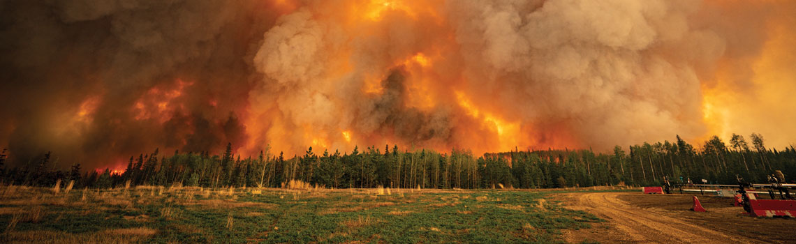
Quebec Wildfires
Updates from the Society for the Protection of Forests Against Fire.
 The picture of the member.
Current Wildfire Smoke & Air Quality Indexes
Learn about wildfire smoke events, the effects of wildfire smoke on your health and how to protect yourself.
 The picture of the member.
Canadian Disaster Database - Fort McMurray Wildfire
 The picture of the member.
Resiliency - Fort McMurray Wildfire